CAPABILITIES
- GIS Graphics and Data Analysis
- Satellite Imagery Analysis and Data Extraction
- Aerial Photograph Interpretation and Remote Sensing Analysis
- CAD to GIS Data Integration
- GPS Surveys and Field Data Acquisition
- Photo Simulation
- Large Format Presentation Graphics and Public Meeting Displays
- Traffic Noise Modeling
- Airport land use compatibility studies
- Expert Witness Testimony
EXPERIENCE
- US 181 Harbor Bridge
- US 183 South
- Muenster Wind Farms
- Plum Creek Mitigation Site
- City of Austin Burleson Road Conversion
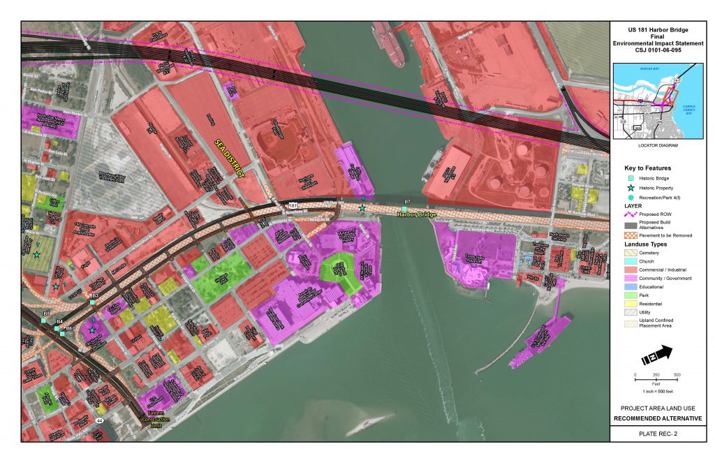
In 2014, Hicks & Company completed an Environmental Impact Statement for the proposed US 181 Harbor Bridge Replacement Project in Corpus Christi, Texas. Data collection, research, analysis and report development occurred over a period of approximately three and half years, following filing of a Notice of Intent in the Federal Register in 2011. This map represents data reflecting the final environmental impact statement.
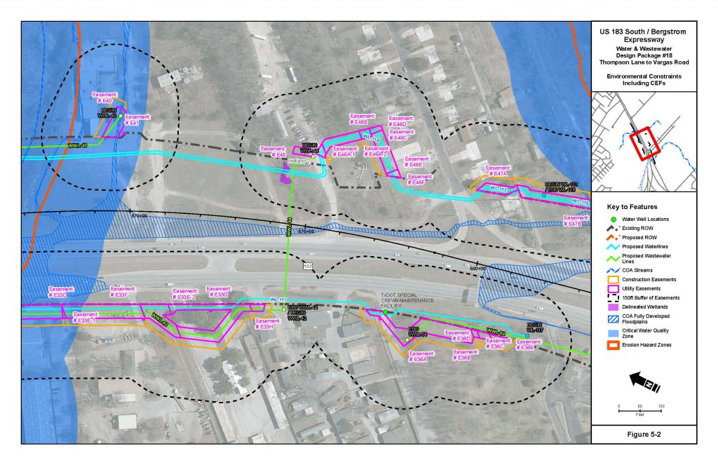
This map depicts environmental constraints, including critical environmental features, for the relocation of utilities along US 183 for the Bergstrom Expressway project.
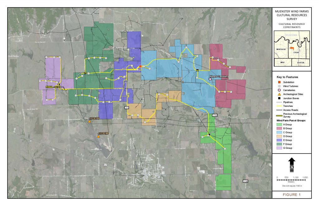
Hicks & Company’s worked with OwnEnergy on the Muenster Wind Energy Project in Cooke County, Texas. The proposed project included the installation of wind turbines and associated collection lines, transmission lines, and access roads – which is detailed in this map below. Hicks & Company provided baseline cultural resources data for planning purposes. To achieve this effort, data regarding the project’s environmental setting, prehistoric cultural background, regulatory considerations, previously conducted Archeological Surveys and Documented Archeological Sites, and non-archeological historic resources were researched.
With the construction of SH 130, there was a need for a compensatory mitigation site to be created to offset the effects the project had on wetlands. Hicks & Company GIS staff were tasked to create plans for various wetland and riparian features during the planning stage of the project.

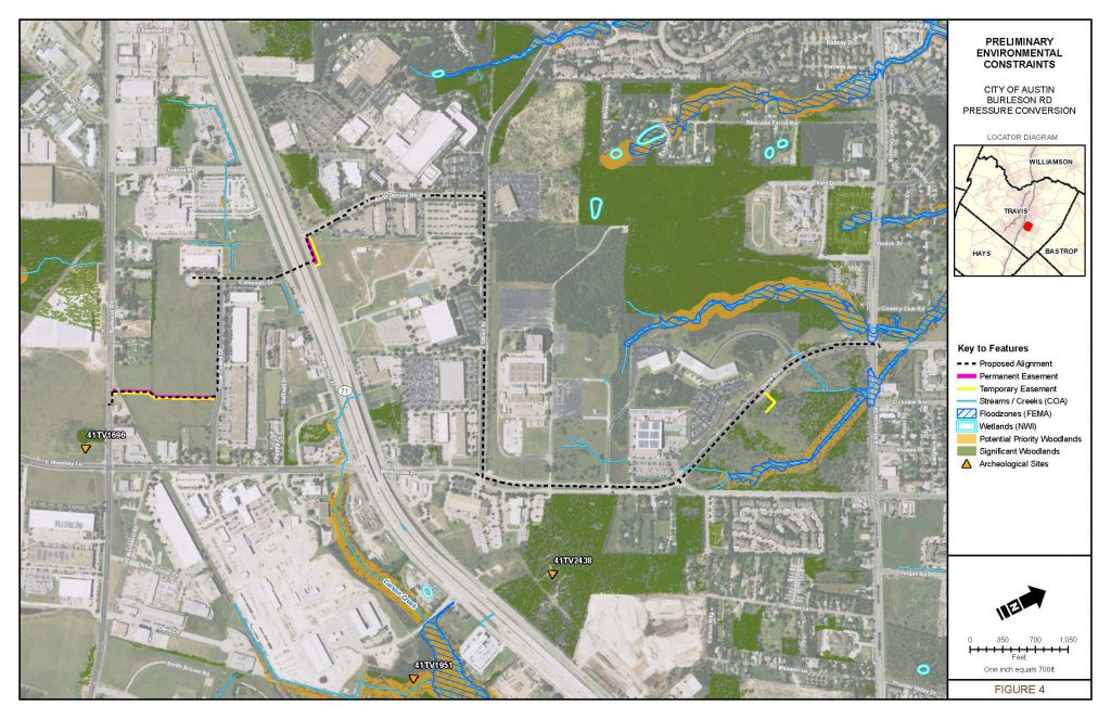
To ensure continued compliance with the Antiquities Code of Texas (ACT), Hicks & Company coordinated with the Texas Historical Commission (THC) in order to revise Antiquities Permit #7177, amending the original Burleson Road project description and area of potential effects to include the current design changes. Following THC’s acknowledgment of these revisions, Hicks & Company conducted an archeological survey of the new segments of the planned alignment. The map below details preliminary environmental constraints.
